Rand McNally
Rand Mcnally Folded Map: Kansas City Street Map
Rand Mcnally Folded Map: Kansas City Street Map
ISBN-13: 9780528025006
Precio habitual
$13.49
Precio habitual
Precio de oferta
$13.49
Precio unitario
/
por
Los gastos de envío se calculan en la pantalla de pago.
No se pudo cargar la disponibilidad de retiro
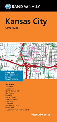
Rand McNally's folded map for Kansas City is a must-have for anyone traveling in and around this part of Missouri, offering unbeatable accuracy and reliability at a great price. Our trusted cartography shows all Interstate, U.S., state, and county highways, along with clearly indicated parks, points of interest, airports, county boundaries, and streets. The easy-to-use legend and detailed index make for quick and easy location of destinations. You'll see why Rand McNally folded maps have been the trusted standard for years. - Regularly updated. - Full-color maps. - Clearly labeled Interstate, U.S., state, and county highways. - Indications of parks, points of interest, airports, county boundaries, schools, shopping malls, downtown & vicinity maps. - Easy-to-use legend. - Detailed index & full street index. - Convenient folded size. Coverage Area Communities Included: Avondale, Gladstone, Grandview, North Kansas City, Northmoor, Parksville, Platte Woods, Pleasant Valley, Raytown, Riverside, Weatherby Lake, Westwood. Product Details: Measures 9.5' x 4' and folds out to 40' x 28'.
- | Author: Rand McNally
- | Publisher: Rand McNally
- | Publication Date: May 23, 2022
- | Number of Pages: Not Available pages
- | Language: English
- | Binding: Map
- | ISBN-10: 0528025007
- | ISBN-13: 9780528025006
Share