Rand McNally
Rand McNally Easy To Read Folded Map: Kentucky State Map
Rand McNally Easy To Read Folded Map: Kentucky State Map
ISBN-13: 9780528025815
Precio habitual
$12.63
Precio habitual
Precio de oferta
$12.63
Precio unitario
/
por
Los gastos de envío se calculan en la pantalla de pago.
No se pudo cargar la disponibilidad de retiro
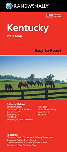
Rand McNally's Easy To Read State Folded Map is a must-have for anyone traveling in and around Kentucky, offering unbeatable accuracy and reliability at a great price. Our trusted cartography shows all Interstate, U.S., state, and county highways, along with clearly indicated parks, points of interest, airports, county boundaries, and streets. The easy-to-use legend and detailed index make for quick and easy location of destinations. You'll see why Rand McNally folded maps have been the trusted standard for years. - Regularly updated, full-color maps. - 48% larger map with a bigger type size than the Rand McNally Folded Map. - Clearly labeled Interstate, U.S., state, and county highways. - Indications of parks, points of interest, airports, county boundaries, and more. - Mileage and driving times map. - Detailed index. - Convenient folded size. Coverage Area Detailed maps of: Ashland, Bowling Green, Covington/Cincinnati, OH; Cumberland Gap National Park, Evansville, IN; Lexington/Frankfort & the Bluegrass Region, Louisville, Mammoth Cave National Park, Owensboro, Paducah. Product Details: Dimensions (unfolded): 28 x 40.
- | Author: Rand McNally
- | Publisher: Rand Mcnally
- | Publication Date: Mar 07, 2022
- | Number of Pages: Not Available pages
- | Language: English
- | Binding: Map
- | ISBN-10: 0528025813
- | ISBN-13: 9780528025815
Share